During the week commencing 4th September 2023, we carried out river restoration works at Coundon Wedge. Coundon Wedge is a Local Wildlife Site in North-West Coventry that extends in a wedge shape into the suburban neighbourhoods of Allesley and Coundon. The site is highly valued as a greenspace by the residents of Coventry and boasts a good range of wildlife within a suburban setting. Coundon Wedge is an openly accessible mix of council managed parkland and council owned land leased out for grazing to local farmers. The site is supported by an active local group – the Allesley and Coundon Wedge Conservation Society, who campaign for the protection and enhancement of wildlife habitat in the area and have successfully created an area of mixed woodland (‘wedge wood’) through tree planting projects.
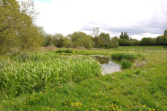
Coundon wedge contains two watercourses, the main River Sherbourne and the North Brook, which feeds into the Sherbourne. These two rivers meet just below a small duck pond near the south of the site, next to Kingsbury academy school.
With approved contractors, Wildbanks Conservation, we carried out a “Stage Zero” river restoration on the North Brook, which has redirected the flow of the brook back to its historical and natural channel. This exciting re-naturalisation was achieved through the Sherbourne Valley Project, a project focused on restoring the River Sherbourne which flows through Coventry, improving it for nature and for local communities. These works will have a positive effect on the river and local nature.
What is Stage Zero River Restoration?
The term "Stage Zero" refers to the state of a river before human disturbance or land use. This approach to river restoration is a recently developed concept in scientific literature, which aims to work with natural processes to restore a river's connection to it's floodplain. This new technique results in a more resilient range of habitats than typical in-channel restoration, with great benefits to river health, wildlife, heritage, sustainability and water storage.
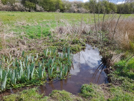
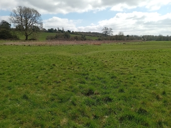
The historic "paleo" channel at Coundon Wedge holding water whilst acting as the natural floodplain.
Update:
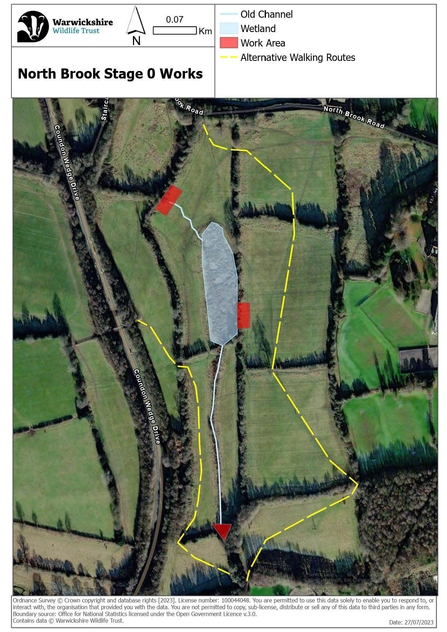
So far, the works have been very successful, with the North Brook having been redirected and now flowing in its historical channel. Access on the site is still very limited, and whilst the feature is settling and arrangements for footbridges are confirmed, please use the alternative routes given.
The restoration work has also been aired on BBC Midlands Today, a recording of the piece can be found here.
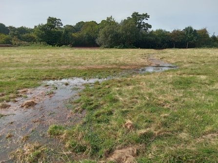
Coundon Wedge River flowing down old channel again after Stage Zero Restoration Works
Reason for works: (Relevant images below)
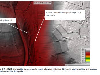
As in many places along the Sherbourne’s course, the North Brook at Coundon Wedge has been subject to a lot of historic modification for human benefit, including channel straightening and the introduction of infrastructure. At Coundon Wedge, the North Brook has been completely realigned so that it is now one single, straightened channel. This straightened channel is ‘perched’ up on the side of the valley rather than where it would have naturally flowed through multiple connected channels along the valley bottom (see figure A, B, C). You can still see the remnants of this in the wetland area and old channel in the adjacent field to the east (figure D & E). The old channel still holds water in sections for large parts of the year and in heavy rain the brook can sometimes be seen breaking its banks around the middle culvert and flowing downhill to the old channel.
The modified channel currently flows through several culverts and a weir, which is situated on a sharp bend at the downstream end of the field and can be seen from the footbridge (figure F). These structures interrupt the natural flow of the brook. They do so by causing issues with movement of sediment and, therefore, natural river processes as well as being a barrier to fish passage.
Reconnecting the brook to its old course will reduce the impact of two of the culverts and the weir on the brook and the wildlife it supports. By bypassing these features and allowing the brook to take a more natural course, it will be connected once again to its floodplain. This will have multiple benefits, including flood prevention downstream and the land acting like a sponge to absorb additional water in flood events. Other benefits include improved water quality from filtering through wetland vegetation such as reeds, and the creation of a more resilient and dynamic wetland system. Restoring these natural processes and creating a more diverse habitat will ultimately bring in a much greater variety of birds, fish, amphibians and invertebrates. This will help to build a thriving local ecosystem that contributes to our overall goal of improving the Sherbourne across the catchment.
*click/hover over images to see figure number and description
Community Consultation
Alongside the Coventry Creature Count event held at Coundon in April 2022, a community consultation was carried out on the North Brook weir mitigation designs and plans. This included some more general ideas around accessibility and events/learning activities at the site. The feedback on the designs and planned restoration works was extremely positive, both in the formal consultation and verbally when discussing the wider context of the plans. 39 people gave their full support for the plans, and 1 gave their partial support, as seen in the pie chart below.
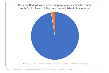
Community Consultation for Coundon Wedge Stage Zero Works
Outline for works:
Length of delivery - The construction period is expected to last 1 week.
Sequencing (earth works carried out under supervision of a consultant geomorphologist and archaeologist):
- Nesting bird, water vole, otter, badger and great crested newt checks will be completed before any tree works begin- if anything is found delivery cannot begin until ecologist is satisfied it is safe to do so e.g. all chicks have fledged
- Contractors will remove/prune only trees/scrub that is necessary for access to deliver the earth works, as well as any invasive species e.g. Himalayan balsam
- Silt control mats will be installed downstream of the works to ensure disturbed silt is captured and removed following works
- Excavate area downstream of the old channel and weir/culverts to specification and in agreement with the supervising geomorphologist to enable the old channel to connect to the current channel. Here it will ‘fan’ across a wider area on re-entry to reduce pressure on the current channel and nearby footpath
- Excavate the upstream lowering area to specification to divert the flow towards the old channel within the adjacent field to the east
- Block the modified channel below the upstream lowering/diversion with the spoil(leftovers) from the excavation
- Block the ditch to the east of the wetland area to encourage flows into the wetland
- Making good any disturbed ground and re-seeding if required
Installation of footbridges
In partnership with Coventry City Council we plan to install two new footbridges over the historical channel (dates TBC). In the interim alternative walking routes can be found in Figure F (below).
